Canada: Great Divide Trail- Sunset Pass TH to Pinto Lake- Day 1

Canada: Canadian Rockies- Sunset Pass TH to Pinto Lake

Total Mileage- 8.50 miles

Total Elevation Gain- 2608 feet

Total Elevation Loss- 1742 feet

The Canadian Rockies! When a person thinks of the best backpacking and most stunning terrain in Canada, Jasper National Park in Alberta is always at the top of the list. Our plan for this 7 night/8 day, 100-mile adventure was to hike from Sunset Pass TH to Pinto Lake where we would hop on the Great Divide Trail and then end our hike on Skyline Trail, which is considered to be the best route in Alberta. Day 1 would take us from the Sunset Pass trail head to Pinto Lake.

Here is a link and free download to the GDT Map Atlas that we used to plan this trip. You can see Pinto Lake on the map above. Our route on the Great Divide Trail (marked in yellow) started on map E50 and counted upward (E51, E52, etc.) Please note that the mileage markers on the map are in kilometers, not miles.

We flew into Calgary, got a rental car, and made a quick trip to the MEC to pick up some bear spray and a few other accessories. MEC is the Canadian equivalent to REI. It is thirty minutes from the airport and along the route to Jasper. As an FYI, you may want to do some research into purchasing bear spray in Canada. If my memory serves me correctly it was quite a process which involved paperwork and a driver’s license. Our plan was to make the five-hour drive to Jasper and stay at the Best Western, which was a couple of hours from the trailhead, and start the hike early the morning of August 3. If you stay in Jasper you need to check out Bear Paw’s Bakery for some amazing pastries and coffee.

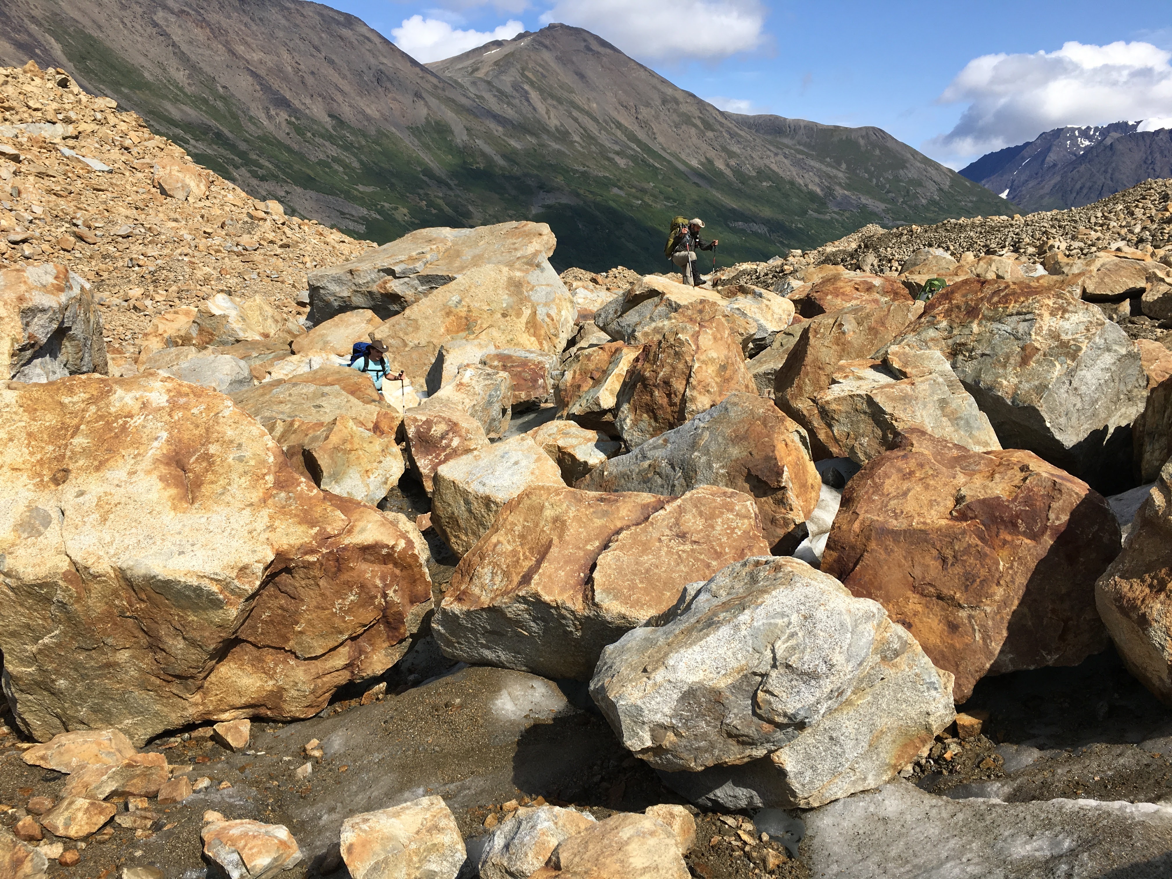
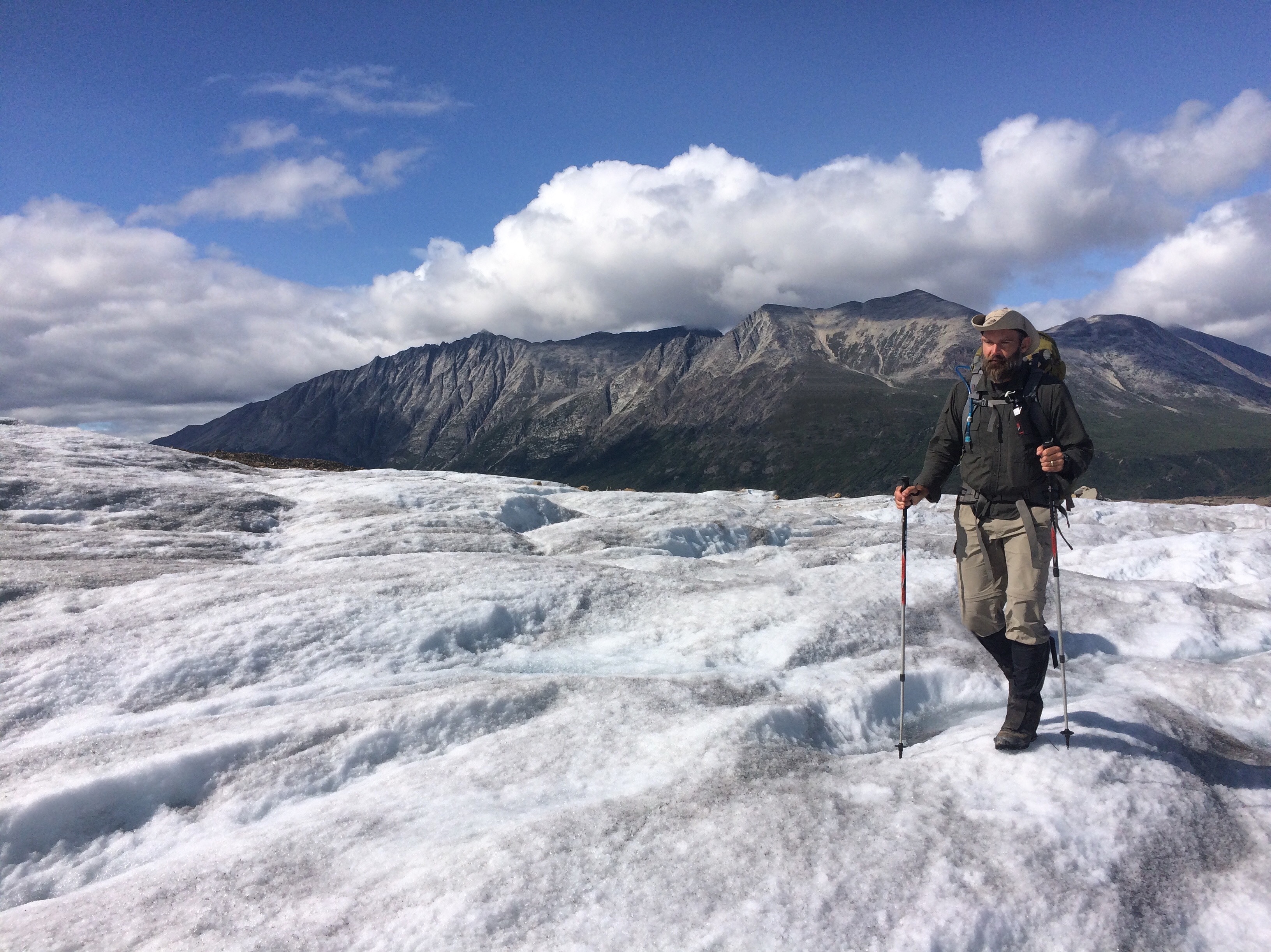
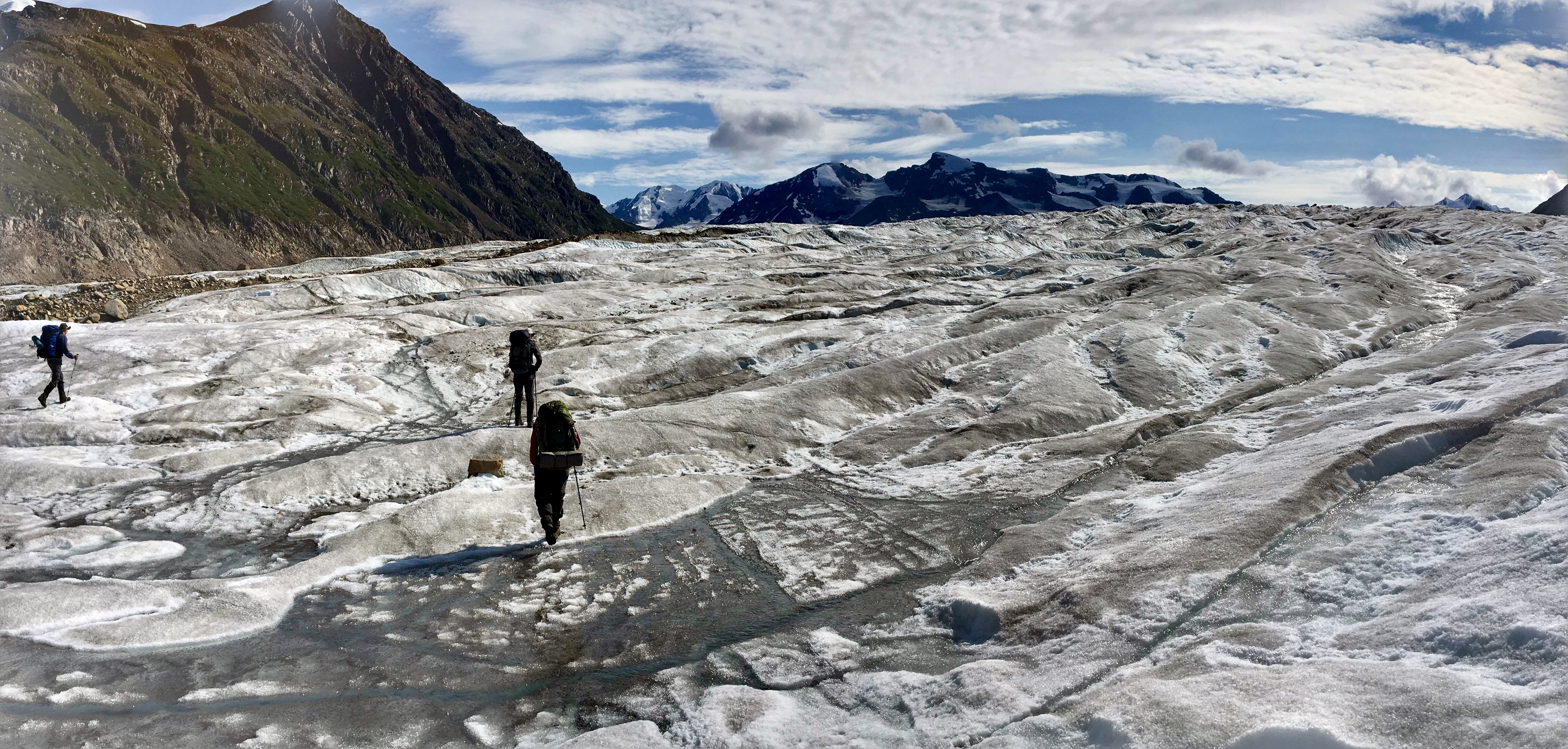
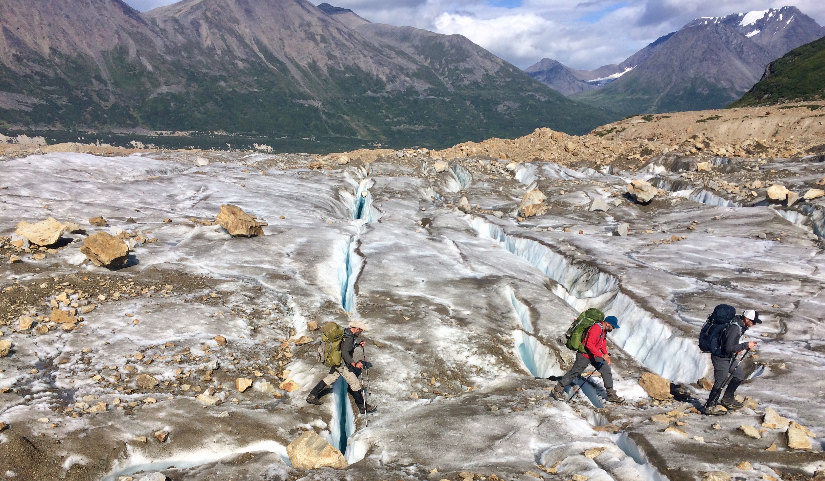
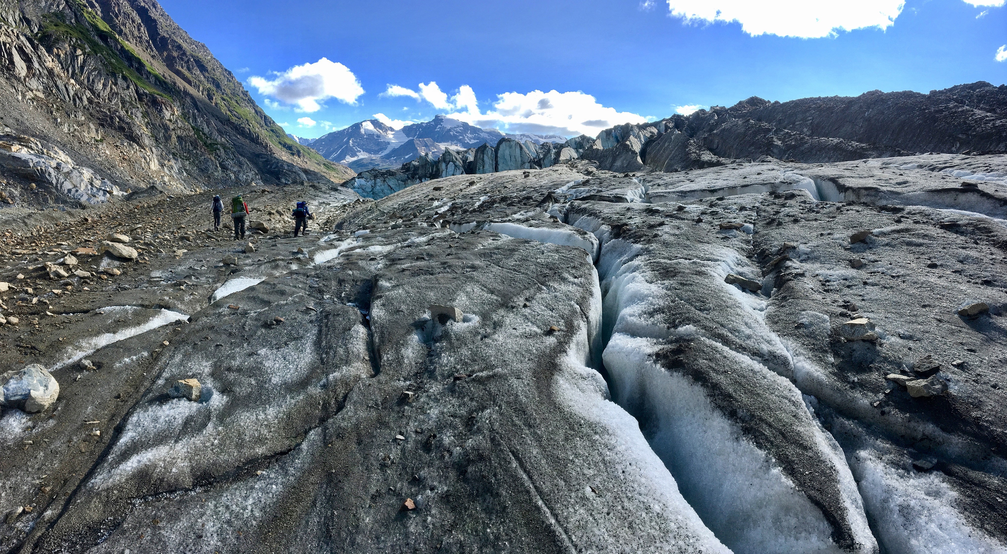
We took Highway 93 from Jasper to Sunset Pass TH. This particular trail is not a part of the Great Divide Trail, but connects to it at Pinto Lake where we would be setting up camp for the night. Let me tell you… there is nothing better than driving for five hours, parking, and then immediately starting hiking UP! For Indiana boys who live at 650 feet above sea level, jumping onto a trail a mile above sea level and immediately climbing to 7300 feet is really something for the lungs.

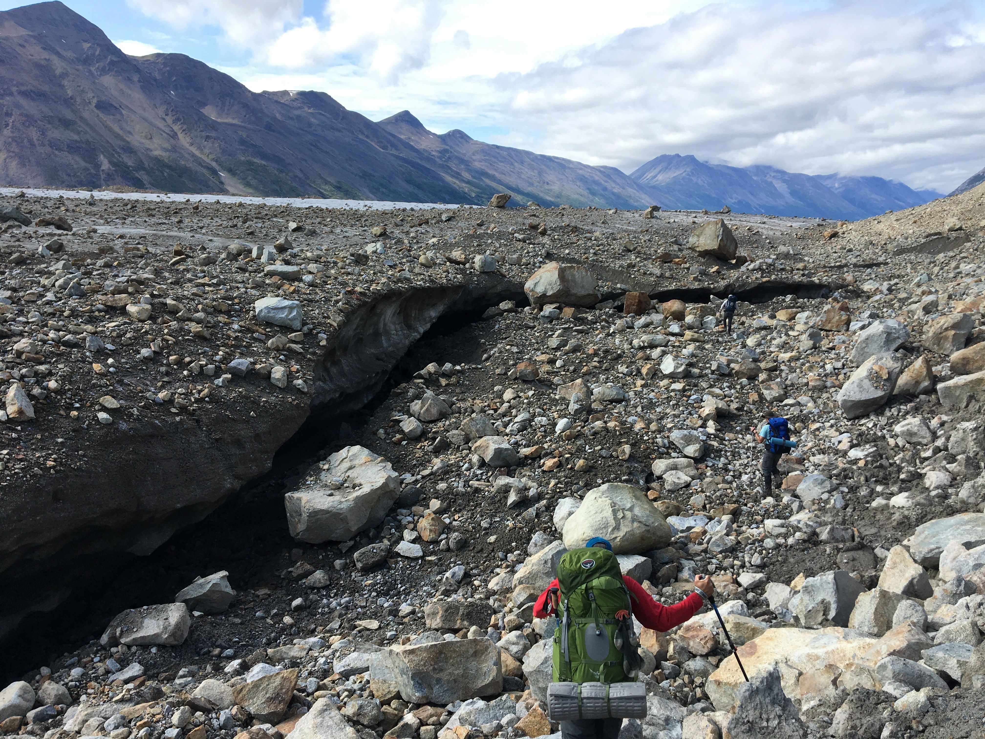
The good thing about our route was that it was all really well maintained and never too overgrown. Compared to the off-trail trips we have done in the past this trail was easy walking. Crossings were made easy through bridges and the dense scrub was easily navigable.

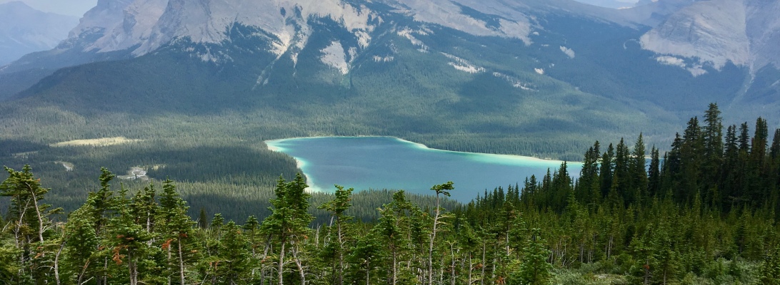
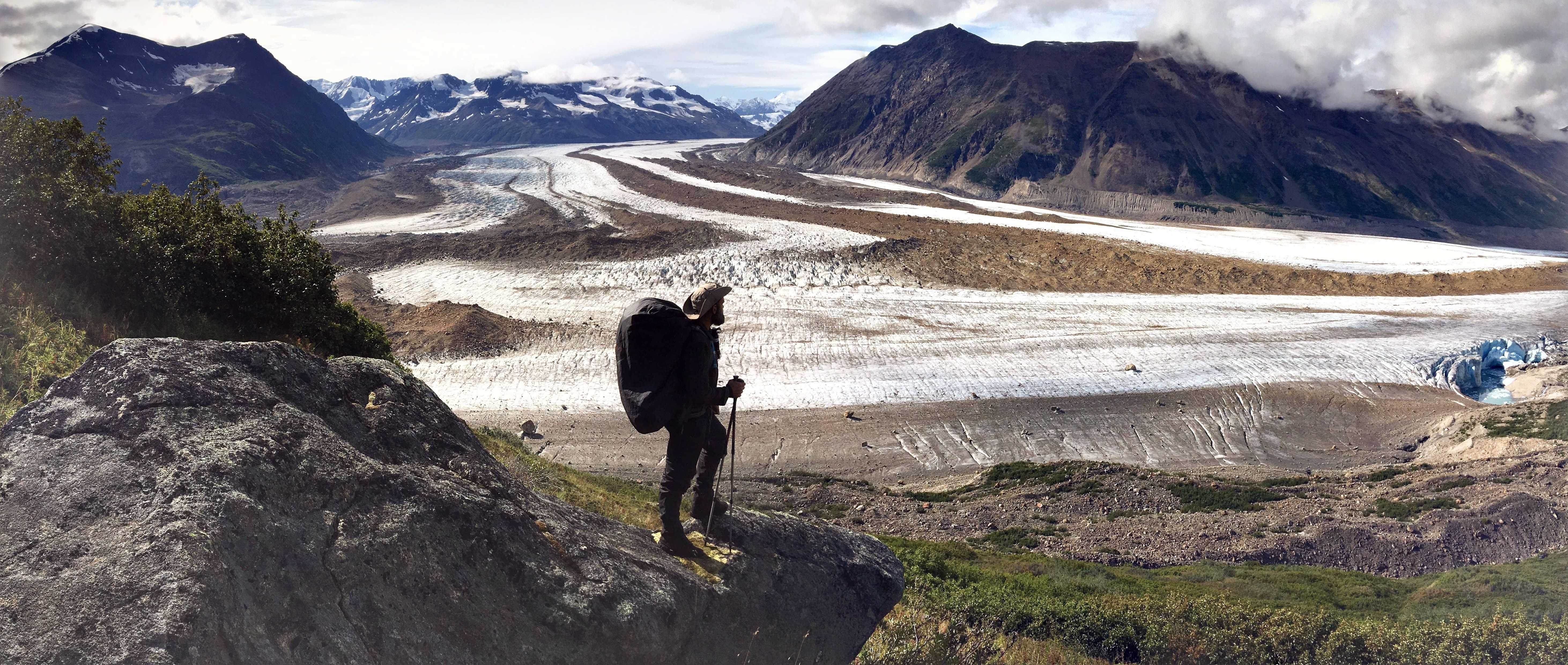
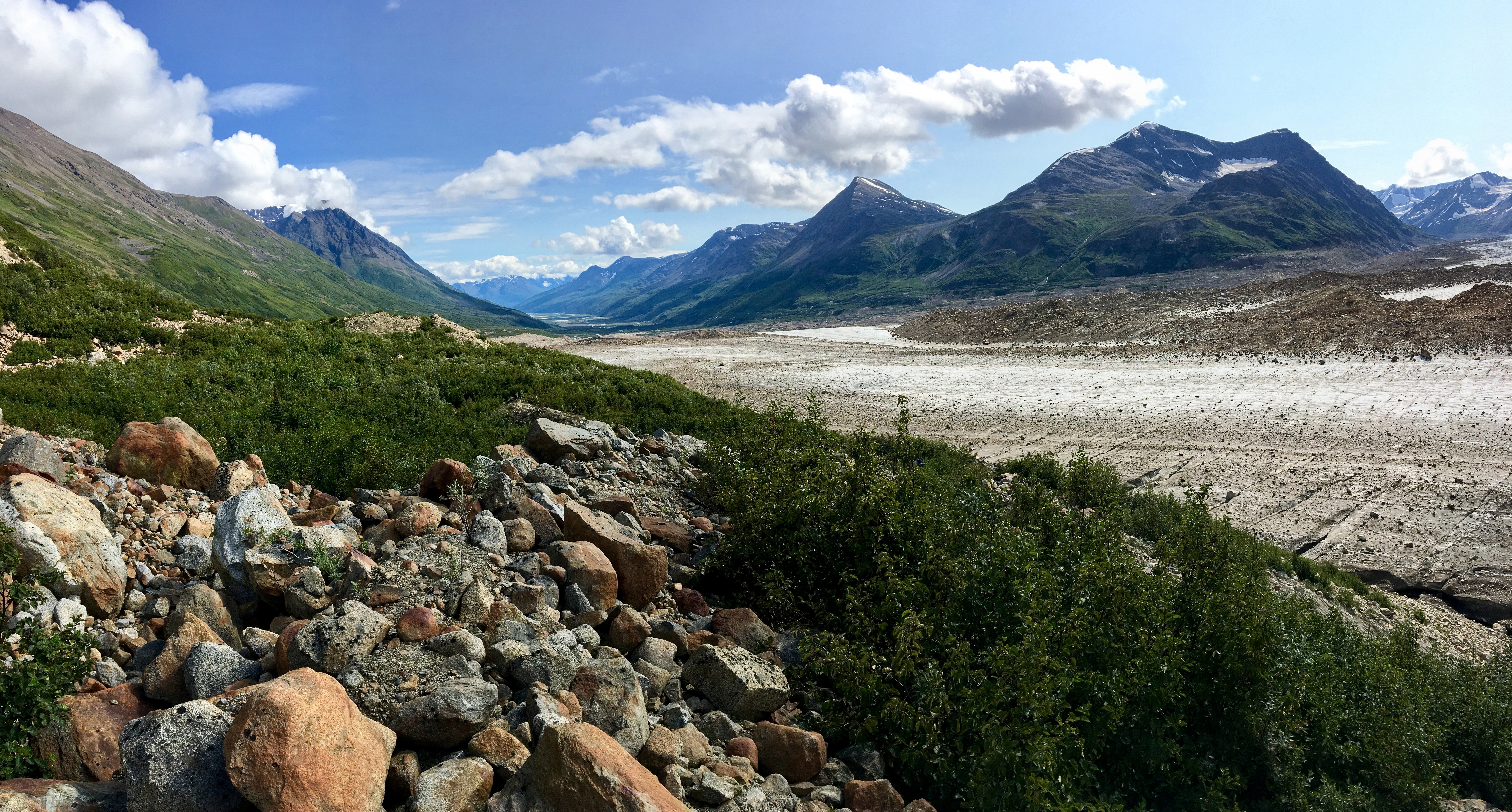
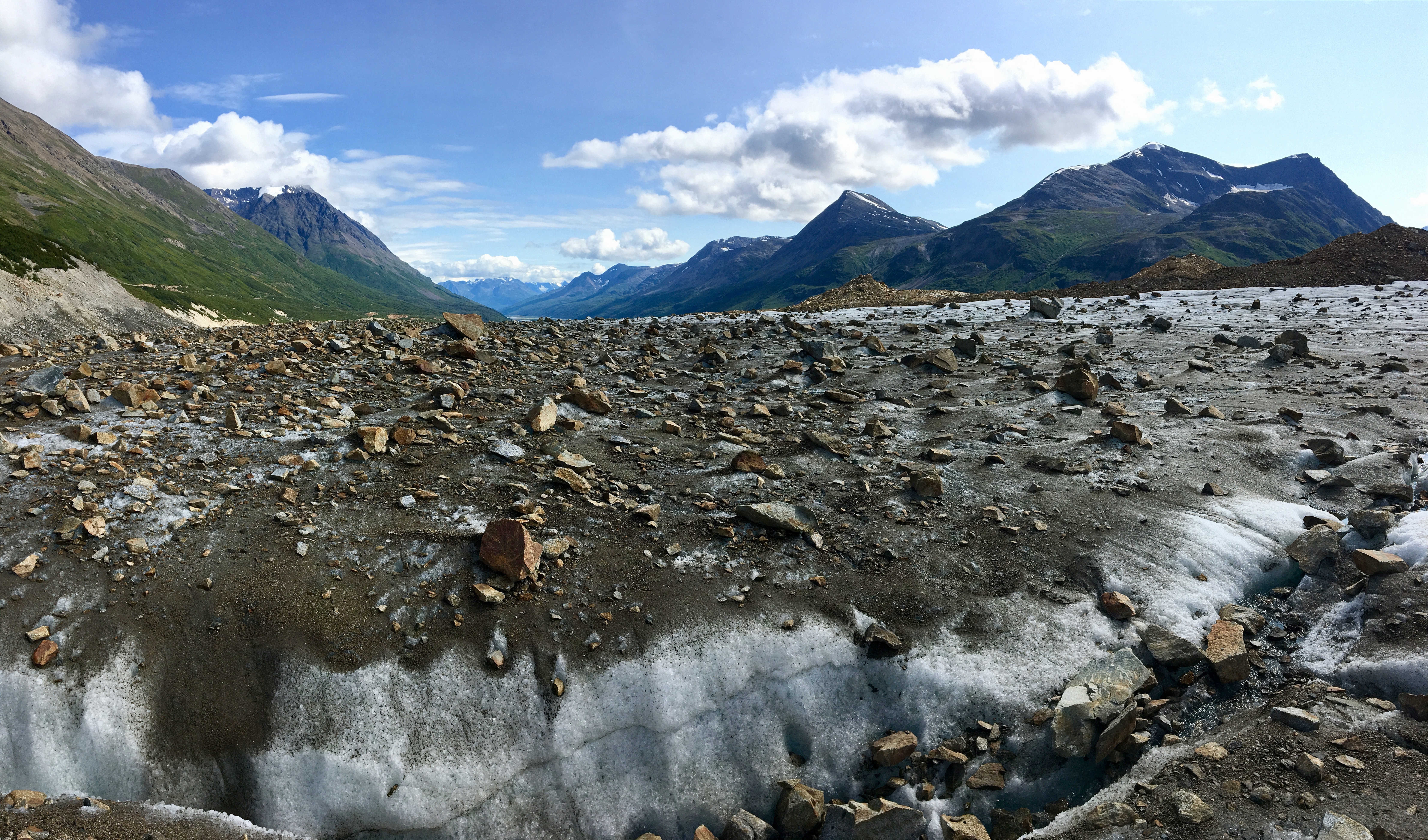
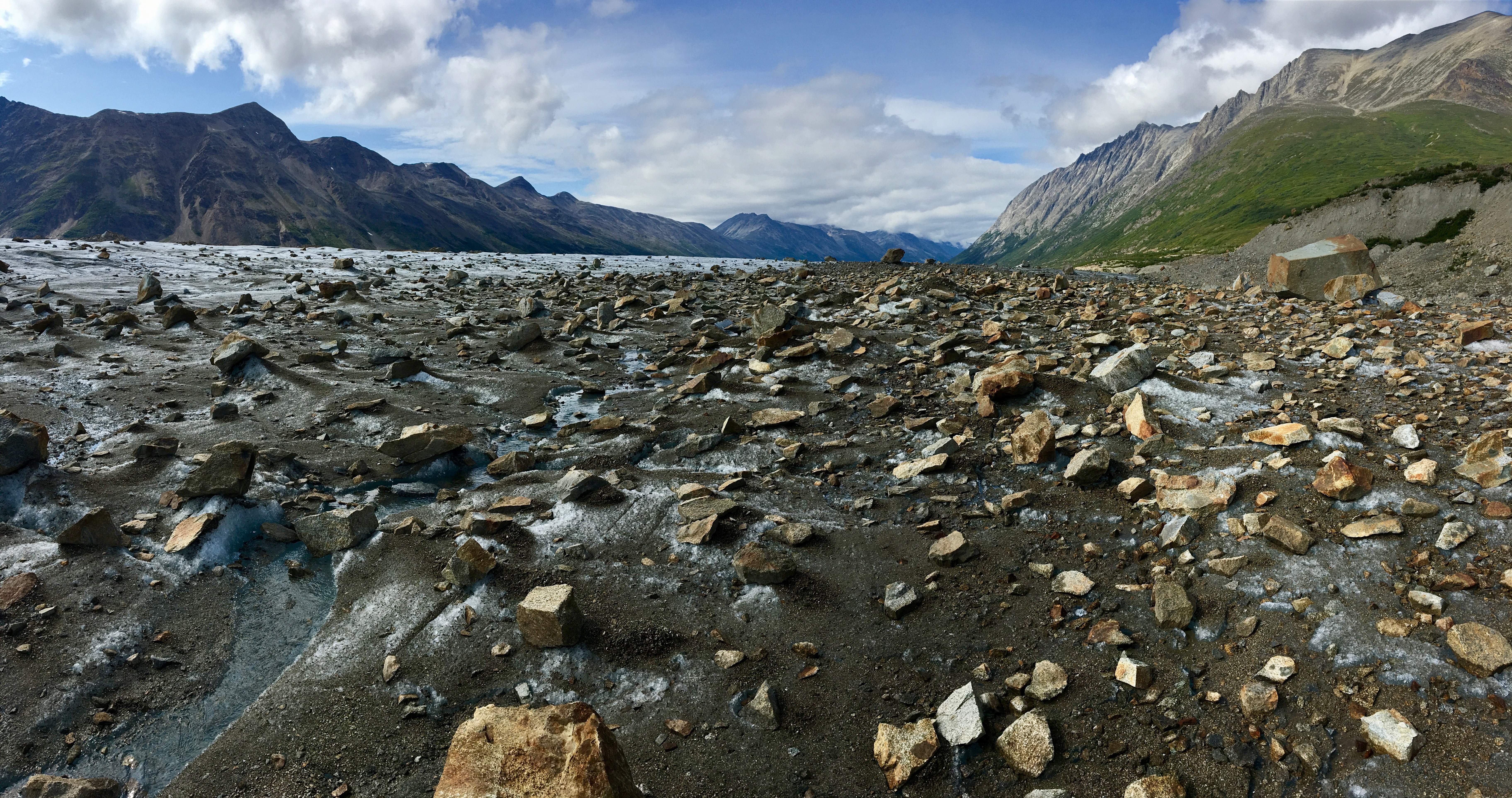
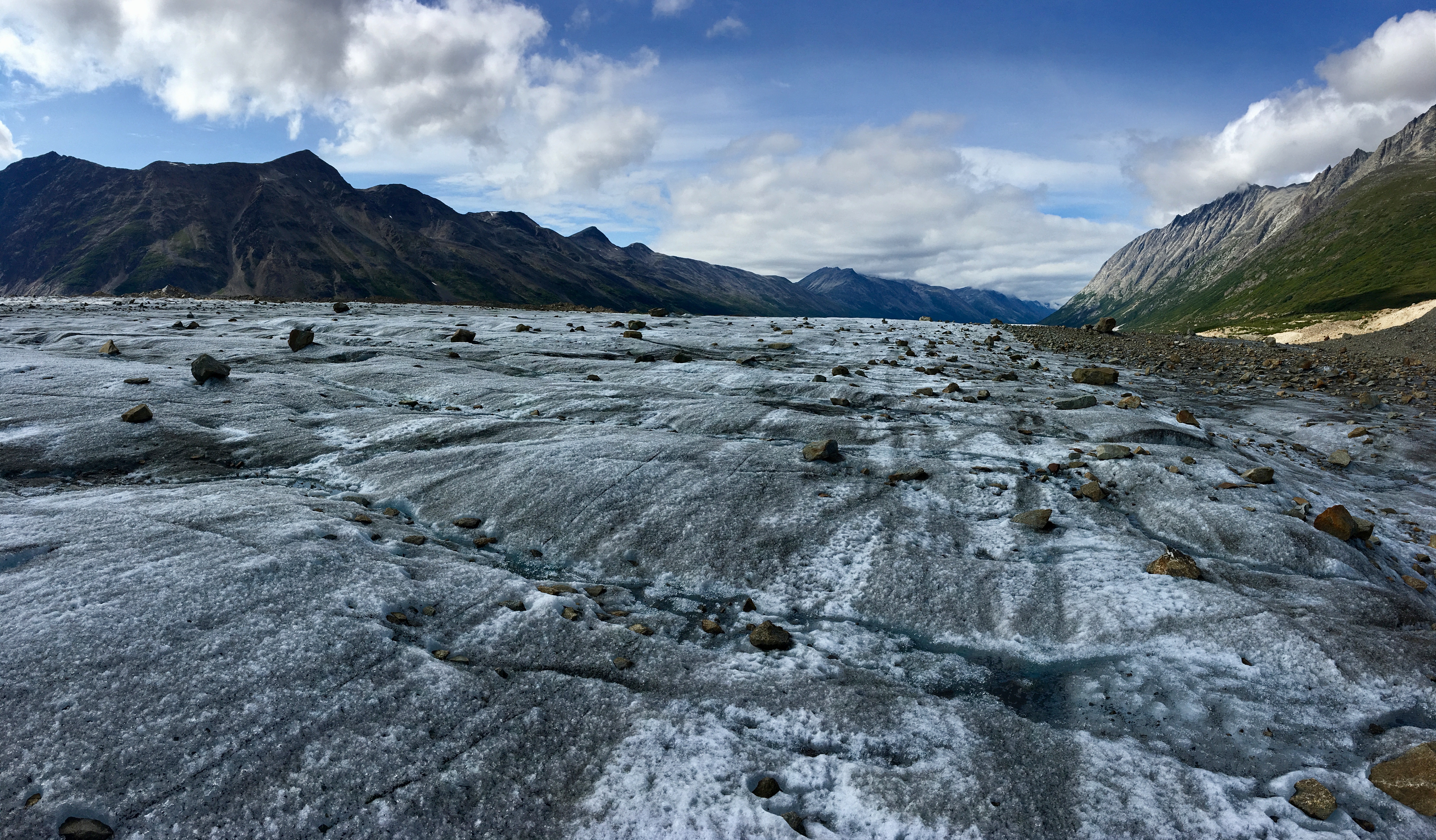
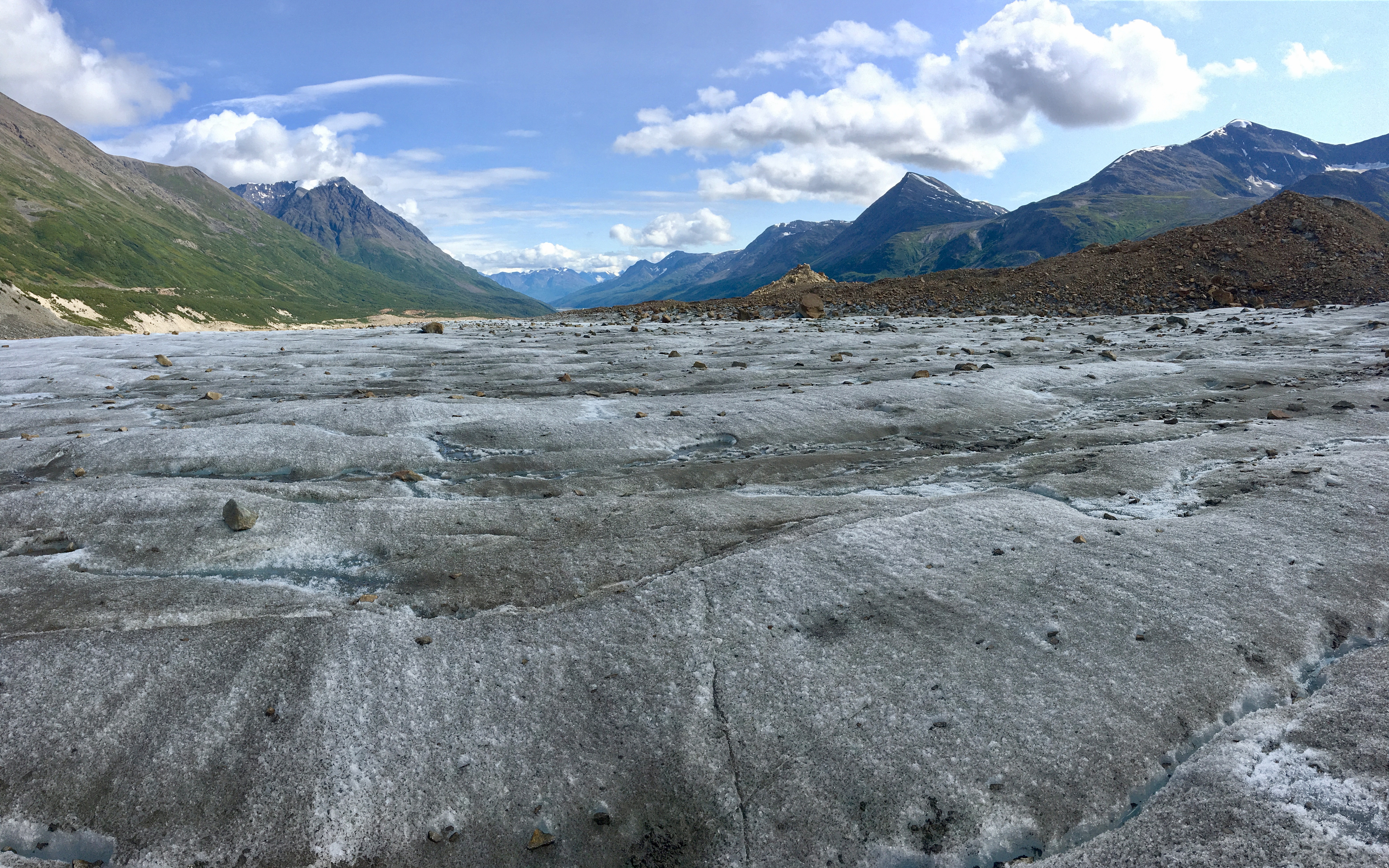
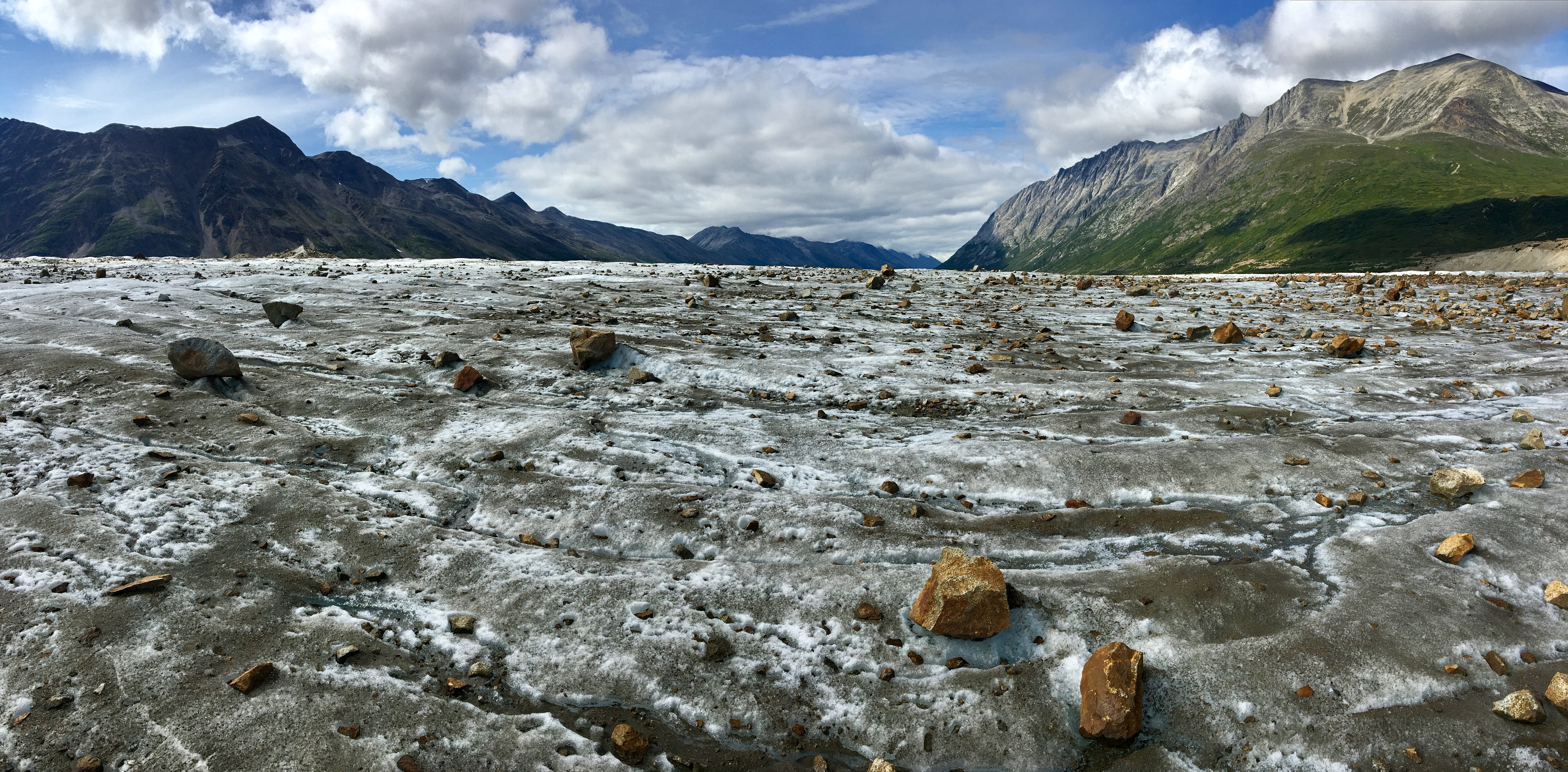
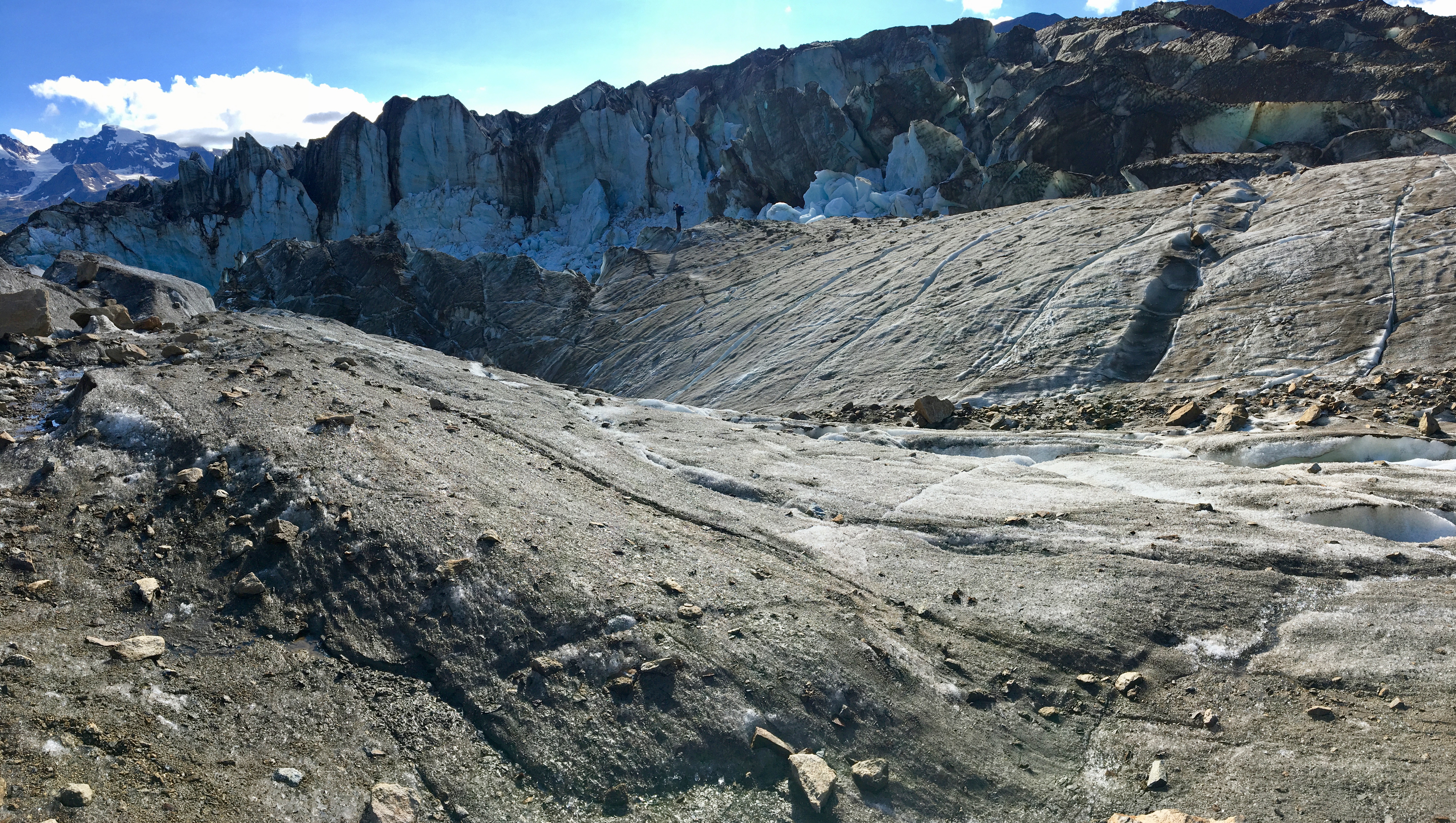
At about the five mile mark we finally got above the tree line and caught an absolutely spectacular panoramic view from above Pinto Lake. When I think back about this area it reminds me of a hybrid between the sawtooth mountains of Glacier National Park in Montana and Denali National Park’s expansiveness.

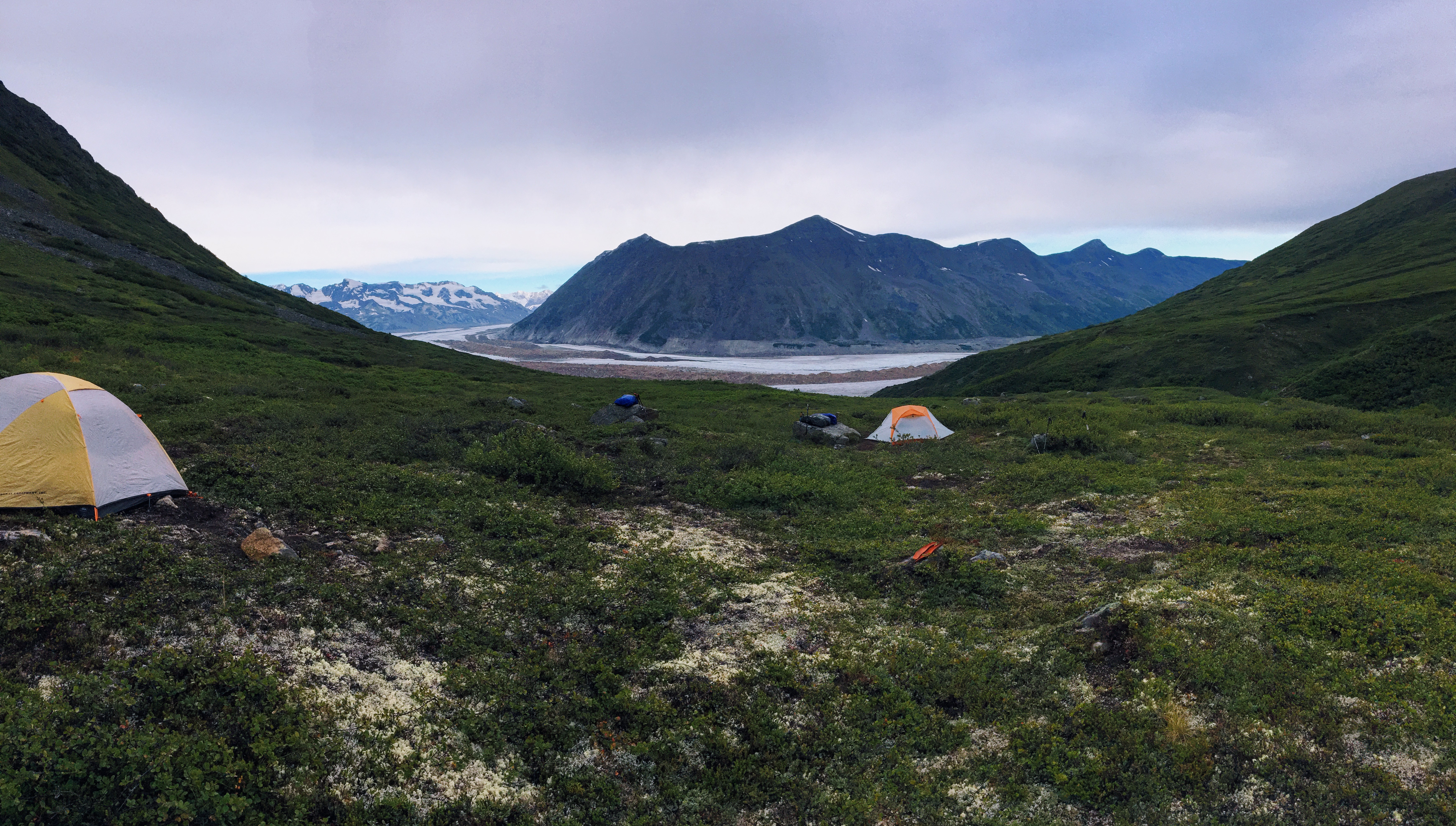
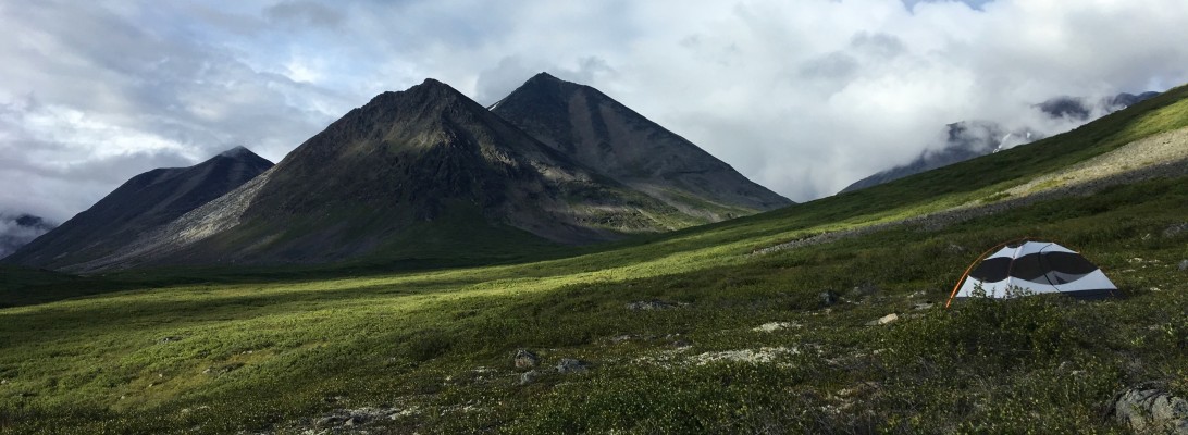
The trail goes down to the north side of Pinto Lake and is a little over two miles from the highest point. As you can see from the map above, once you connect at the Great Divide Trail juncture there are camping spots near the lake. For Pinto Lake camping there are not any permits to purchase. I didn’t get any pictures of the camping area (sorry), but I believe there were plenty of spots to camp.

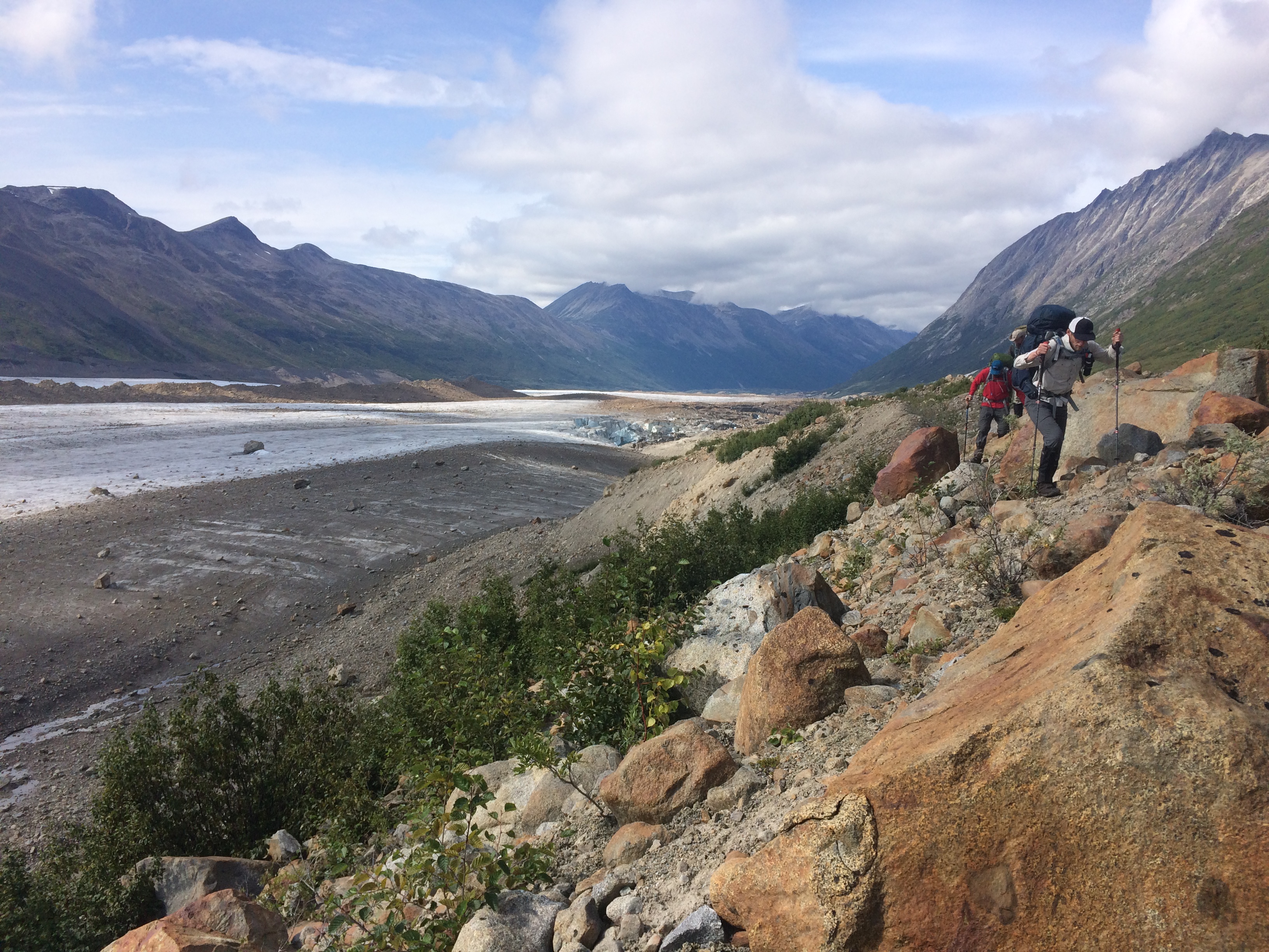
Day 2 will take us from Pinto Lake along the Great Divide Trail in the White Goat Wilderness to Cataract Pass.

Alaska: Wrangell-St. Elias National Park- Bremner Glacier Overlook to Bremner Glacier- Day 3

Alaska: Wrangell-St. Elias National Park- Bremner Glacier Overlook to Bremner Glacier

Total Mileage- 6.8 miles

Total Elevation Gain- 1714 feet

Total Elevation Loss- 1868 feet

Screen Shot 2018-08-19 at 11.18.14 AM

Screen Shot 2018-08-19 at 11.48.26 AM

Day 3 in Wrangell-St. Elias in Alaska took us from the Bremner Glacier overlook down to crossing the Bremner Glacier. The first two miles of this day had the potential of taking up most of our day. I say that because to get down to the glacier we would have to navigate through dense alder. And when I say dense, I mean dense. There were really only two considerations at this point. It was to either take the low route, which would invariably mean that we would be bushwhacking for the next five plus hours. Or, take the high route above the alder and hope for an animal trail that would cut through the alder. After much discussion and blueberry picking, we decided to take the high route and pray for an animal trail. Thanks to Josh Brown on this one, as he scouted out a bear trail that, within one hour, led us all the way down to a one-hundred foot overlook of the glacier where we took a long lunch break. Finding the bear trail was a thing of beauty and a huge time saver.

IMG_3930IMG_3937-2IMG_3932-2IMG_3935-2IMG_3939-2IMG_4064IMG_4068IMG_4072IMG_4446IMG_4074

The easiest route down to the glacier after our lunch break was a rock slide. We followed it down and came face to face with Bremner Glacier, which we had to find a spot low enough to step up onto it. Our trek across Bremner was nothing short of stunning. We had previously watch a pair of wolves run across the glacier during our lunch break, but now we were traversing the glacier ourselves and experiencing its vastness. Alaska always reminds you how infinitesimally microscopic you are when you are swallowed whole by its size. What looked like a quick cross from a higher vantage point, became a few hour endeavor. Our initial plan was to cross the glacier and then take a high route over the adjacent mountain to reach our camp for the day. However, we met a guided group in which the leader encouraged us to stay on the glacier the entire way to our camp. He said it was much more visually stunning. So, rather than beat the bush, we trekked across the glacier…and we were better for it.

IMG_9934IMG_4116IMG_3981-2IMG_3984-2IMG_3987-2IMG_3989IMG_3991IMG_3993IMG_3996IMG_4003IMG_4458IMG_4010

For the most part, this was an easy route. The crevasses were relatively narrow on our path. However, had we taken a more westerly route, rather than a southeasterly route, we would have entered areas that would require technical skill and equipment that we did not have. We simply wanted to cross the glacier for the views and to reach our end destination for the day. As we stepped off of the glacier in that southeastern corner that hugged the edge of a mountain, we could see the height of Bremner and how imposing its accumulation was.

IMG_4021IMG_4530132748BF-6512-4162-921A-20AC4FFDC58DIMG_9993IMG_4286-2IMG_4037

The last portion of this trek led us up and away from the glacier on top of a rocky shelf. The campsite we chose had a brilliant view of the towering edges of the glacier. Our next day would take us through a staggering valley and closer to our end point at Iceberg Lake.

Day 4- Bremner Glacier to Iceberg Overlook

Alaska: Wrangell-St. Elias National Park- Monahan Creek to Bremner Glacier Overlook- Day 2

Alaska: Wrangell-St. Elias National Park- Monahan Creek to Bremner Glacier Overlook

Total Mileage- 8.83 miles

Total Elevation Gain- 1475 feet

Total Elevation Loss- 2350 feet

Day two in Wrangell-St. Elias National Park would take us from the Monahan Creek area to a beautiful overlook of the Bremner Glacier, which we would be tackling on Day three. The day started out in classic Alaskan style- gray skies, low hanging clouds, and rain. The goal for the morning was to stay above the brushy areas, but stay below the loose and steep scree areas. If this is done correctly it will be relatively easy trekking across some basketball-sized rocks. The key is to work your way down the valley with an eye toward the Monahan Creek junction and the saddle which you will be passing over. The best advice is to minimize areas of alder while working your way toward Monahan Creek. We had to search for a while to find a spot to cross over the creek, but eventually found some stepping stones that kept us from getting our boots wet. That was a huge win. But you have to keep your eyes open, because much of the area has steep walls to the creek or water moving too powerfully to cross.

Upon the creek crossing we were on our way over the saddle that would lead to Bremner Glacier. We had to make a decision on how far we really wanted to go on this day. If we went too far, we would commit to several hours of dense alders that descended to the glacier. Did we really want to end the day with that kind of battle? If we went into the alder for the remaining part of the day, would there be anywhere to camp without having to commit to crossing the glacier in the same day? Committing close to nine untrailed, Alaskan miles before the alder and glacier seemed like enough for one day. So we knew that the next day was going to be the monster day- alder/glacier. At least we would have the evening and night to mentally prepare for it. Dense alder will make you wish you were back on the dirt trails in Indiana. I have yet to find a fan of alder bushwhacking. Nonetheless, the terrain for this portion of Day 2 was ideal for backpacking, but the boulders heading up to the saddle was a little work.

Once we hit the saddle we could see where the dense cloud cover was coming from- the glacier. And we saw for the first time… blue skies. As I mentioned in the previous post, the Bremner area from which we came seems as if it gets a lot of cloud cover and rain, likely due to the cold air coming from the glacier. Am I no meteorologist, so I am likely wrong, but on subsequent days we would look back and see gray skies and rain even though we were in clear skies. The green in front of us was a beautiful, but I am not sure how to classify it. It was a somewhat marshy area with a mixture of knee-high scrub, longish tussock, and scattered alder. The issue, as you can imagine, is where to set up a tent. If there was a spot clear enough for a tent…it was marshy. To be honest, even though it wasn’t a huge issue, I feel like finding spots to camp throughout the week took some work. It’s not like you can just pop a tent anywhere. Most areas were overgrown or rock strewn or not close to fresh water, etc. On this day we had to make due with a bit of an angle, which made for a cool pic below, but it was really the best we could do. I think the other guys got to the flat spot before us and we got the consolation angle. I slept well regardless.

The next day, Day 3, would take us through the alder and down to Bremner Glacier for one spectacular day.

Day 3- Bremner Glacier Overlook to Bremner Glacier

Reblog: All Creation Sings

Hey lovers of the outdoors!

I wrote a new post on my other blog entitled All Creation Sings.  I recount a specific moment in Alaska when summiting Mt. Eielson when I saw Denali for the first time.  It is a faith post, so if that’s not your thing you may choose to disregard… but I thought you each would identify with the emotions that I share in the post.

Btw… I am heading to Wrangell St. Elias NP in Alaska at the beginning of August for a week in the wilderness.  New trip reports will be coming then.

Peace…

Brandon

Wyoming: Wind River Range- Titcomb Lakes to Trails End Campground- Day 4

Wyoming: Wind River Range- Titcomb Lakes to Trail’s End Campground

Total Mileage- 14.00 miles

Total Elevation Gain- 2125 feet

Total Elevation Loss- 3334 feet

screen-shot-2016-12-07-at-6-03-08-pm screen-shot-2016-12-10-at-6-37-04-pm

Our fourth and final day in the Wind River Range area of Wyoming would take us from Titcomb Lakes to Trail’s End Campground.  The previous day threw a monkey wrench into our plans, as we were planning to hit Bonney Pass and take The High Route north for several days.  An expected snowfall would have made our attempt too risky so we opted to exit through Titcomb Basin to Trail’s End Campground.  While this was a massive downer, our trek through the basin was amazing.  The views were nothing less than spectacular.  The big decision that we had for this day was whether we were going to hit the full 14 miles to get out- or – do one more night.  At this point it was really a decision based on how everyone was feeling.

img_1535img_1556img_1557img_1561img_1567img_1574img_1575

This 14-mile trek would add up to some significant elevation changes, both ascending and descending.  To be honest, I was a little surprised that we gained over 2000 feet, but we had not game-planned this route and really did not know what to expect.  Surprisingly, the only reason we had a map for this trail is that on the previous day when we decided to not tackle Bonney we ran into some speed packers who let us take some pictures of their map.  I suppose had we not had their map as a reference we would have still made the same trail out, but their map gave us an approximate mileage and an approximate end destination.  But for the time being, we saw a beach and a lake.  And that ALWAYS means a polar plunge.  No joke, the water temperature was in the 40’s.

img_1581img_5071img_1597img_1598img_1602img_1810img_1607img_1611

To give you a bit of an idea about this 14-mile hike, about the first half of it (the portion coming from Titcomb Lakes) is amazing.  The entire time I was hiking I thought that it would be a great stretch to hike and camp with my kids on another trip.  Camping at Titcomb Lakes was nothing short of stunning and the views of lakes/mountains was really special.  However, the final half of the hike is not pretty at all.  It is mainly a wide multi-use trail that descends among the trees making for a long, repetitive seven miles.  That was the unfortunate part of this last portion- if you wanted to hike to Titcomb Basin and hit the lakes… it would take a really long and suffocating initial hike to get there.  Needless to say, I didn’t take a lot of pictures the last seven miles.

img_1639img_1641img_1647img_2369img_1659img_1672img_1675img_1676

We popped out of the woods and into the parking lot close to Trail’s End Campground.  We were not intending to camp there, but were looking to hitchhike back to Pinedale for the night.  Our vehicle was still at the Green River Lake parking lot.  The unfortunate part of ending our hike at Trail’s End Campground without a vehicle was that this road was sparsely traveled… and the people who actual did drive by were… surprise, surprise… coming back to camp for the evening and NOT going to Pinedale.  We had a couple of people stop, but they were unwilling to drive us into town.  Cell coverage was terrible and extremely spotty, but one of the guys was able to text his wife and ask her to get a shuttle set up for us.  Unfortunately, communication between us and the shuttle service completely broke down and they said that the earliest they could get us (even if they wanted to) was 11pm.  This was strange because we were only a 30-minute drive from them.  We think they were unclear on where we actually were.  To our complete dismay, we were planning to camp in the parking lot, but then… all of a sudden… a truck slowly turned on to our road.  With three of our guys working at the corporate headquarters of Cummins Engine Company in Columbus, Indiana… they were surprised and blown away that the driver of the truck not only had a Cummins engine in his truck… he was wearing a Cummins baseball cap.  The stars aligned.  As it turned out, the man, his wife, and daughter came up to that area to release balloons in remeberance of the daughter’s husband who had passed away a year from that date.  They had just finished when they decided to just crusie around and look at the views before they went back to Pinedale.  They very kindly loaded five guys, five packs into the covered bed of the truck and we were off to Pinedale.  There are still some amazing people in this world and we were fortunate to have crossed paths with them.

img_5119img_1679


Wyoming: Wind River Range- Three Forks Park to Peak Lake- Day 2

Wyoming: Wind River Range- Three Forks Park to Peak Lake

Total Mileage- 9.3 miles

Total Elevation Gain- 3917 feet

Total Elevation Loss- 1383 feet

screen-shot-2016-12-07-at-6-00-42-pm

screen-shot-2016-12-10-at-6-33-48-pm

On Day 2 we would be hiking from Three Forks Park to the Peak Lake Area, which would take us just over 9.3 miles for the day and close to 4000 feet of elevation gain.  This trek is a fairly gradual ascent with the last couple of miles, as we head eastward off-trail, being significantly more slow going.  This early September morning was overcast and cool and it would stay that way the entire day with intermittent frozen precipitation.  I say “frozen” because what we experienced was not ice, sleet, or snow.  It was frozen rice-sized precipitation that was chewy before it melted in my mouth.  It was surreal, but more on that later.

img_4888img_4891img_4890

From Three Forks Park the Highline Trail begins a gentle climb, still hugging the Green River, initially enveloped in pine but then opening up to some beautiful autumn colors.  At about 8400 feet the Highline begins to switchback southwest about 800 feet to Clark Creek, which is an easy cross.  Around the Trail Creek Park area some 11,000 foot unnamed peaks begin to pop up on either side, making for some amazing views.

img_1283img_1286img_1287img_1294img_1296img_1299

It has been a gradual climb up to this point and relatively uneventful. I can’t say the same thing for the second half of this day.  Beginning at Vista Pass, the sky darkened and began to rain and thunder as we trailed into the high country.  We stopped long enough to pull out our raincoats and then proceeded.  But the thunder intensified and the rain turned to soft ice pellets.  It was a strange precipitation. It was the size of rice and when I put it in my mouth… was chewy before it melted.  I have to be honest and say that I have never felt so close to thunder in my life.  I could actually feel it when it would rumble.  We knew that we needed to take shelter immediately.  Fortunately we were close to a boulder field which yielded a nice “cave” for us to duck into until the storm subsided.  After about twenty minutes holed up we were in the clear to begin a very tiring trek through the boulder field up to Cube Rock Pass and Dale Lake.

img_1303 img_1313 img_1315 img_1322 img_1325 img_1327 img_1328 img_1330

Dale Lake sits at about 10,700 feet above sea level and is directly west of Peak Lake.  There are some decent spots to camp west of Peak Lake, but our plan was to circle northward around Peak and camp in the basin just east of the lake.  As we looked at our route around Peak Lake, we could not immediately make out the trail, but as we got closer it was apparent that the trail actually hugged the lake tightly en route to the basin.  I should say that the precipitation did not let up.  In fact, we were still getting pelted by the rice-sized ice.  To be honest, I was ready for the storm to blow over… and it eventually did as we found a spot to set up camp.

img_1333 img_1335 img_1338 img_1342 img_1344 img_1350 img_1353

We set up camp in the basin just east of Peak Lake in a really, really sweet spot.  Directly to our east we could see the first pass we would tackle the next morning in Knapsack Col.  The sun broke through just before supper.  We had some magnificent views all around and some really great spots to sit among the broken boulders. As the day closed out we knew that the next day was going to be our most challenging in terms of elevation and going off-trail.  We were going to hit Knapsack early the next morning and then tackle Bonney Pass as our entrance into The High Route.  Little did we know that our plan would change so dramatically in the middle of the night.

img_1356 img_1357 img_1362 img_1363 img_1364 img_1366

Day Three would take us over Knapsack and down passed Twins Glacier to make some tough decisions about how we were going to proceed with the remaining planned hike.  The elements were going to be a huge factor (and game changer) for this trip.

Wyoming: Wind River Range- Green River Lake to Three Forks Park- Day 1

img_1237-2

Wyoming: Wind River Range- Green River Lake to Three Forks Park

Total Mileage- 10.74 miles

Total Elevation Gain- 2033 feet

Total Elevation Loss- 2004 feet

screen-shot-2016-12-07-at-5-58-02-pm

screen-shot-2016-12-10-at-6-31-42-pm

Let’s start out with the fact that we had to alter our trip on Day 3 because we were unable to hit Bonney Pass due to ice and snow.  I will discuss this more on the Day 3 post, but if you are looking for a loop route that hits a significant portion of the Sierra High Route, you won’t find it here.  We took the conservative options and readjusted our route, opting not to test Mother Nature.  I believe that we attempted this route a week too late, as we started Day 1 on September 3.  Typically the first heavy snowfall doesn’t hit until the middle of the month.

Day 1 was beautiful as we approached Green River Lakes parking lot.  It was everything we hoped it would be- mid-60 degree weather with no bugs, blue skies, white puffy clouds.  We believed that the first week of September would be the sweet spot with no bugs, cool days/cold nights, and little to no snow.  We typically anchor our trips to Labor Day so we save a vacation day, however starting on this particular weekend meant more human activity than we really wanted.  We always hope for complete solitude, but everyone was no doubt trying to get in their last trip before the snow.  In retrospect, we should have considered the last week of August.  Had we done that we likely would have eliminated some of the people traffic and avoided the first big snow of the season.

img_1187img_1188img_1190img_1206

Our goal for Day 1 was to hit Three Forks Park (10.7 miles), which is a really nice, open basin area with plenty of camping opportunities at the confluence of Green River, Wells Creek, and Clark Creek.  As we left the Green River parking lot there were spectacular views of Square Top Mountain.  There are a couple of trail options from the parking lot.  We opted for Lakeside Trail that hugged the west side of the first lake.  There is also a trail on the east side of the lake that is a more direct route.  The east side trail is Highline Trail, also labeled Continental Divide Trail.  Either trail works.  If you take Lakeside Trail there is an eastward cut-across after the first lake that takes you over to Highline Trail.  While we had amazing views on Lakeside Trail, I would probably recommend taking the eastward trail simply because it is more direct and you may get better views of Square Top.

img_1220 img_1225 img_1234

After the eastward cut-across, we took a quick snack break.  We were at about the 3.5 mile mark.  The next three miles were relatively flat (a few ups and downs) with great views of Flattop Mountain and the second Green Lake.  The waters are an absolutely stunning Caribbean blue in which you can actually see fish swimming.  Later on the trip we stripped down and jumped in one of the lakes (more on that later), but the water temps in early September were in the 40’s.  Nice and shockingly cold.  The trail was well-established and visible worn for easy backpacking.
img_1236 img_1237-2 img_1242 img_1251 img_1258 img_1271 img_1747

The final three miles to Three Forks Park were a gradual ascent.  Overall, this was a very leisurely and beautiful 10.7 miles.  We averaged just under 2mph and it took us a little over six hours.  We could have very easily gone faster, but we took our time and enjoyed the views.  Three Forks Park is a really nice, open meadowy area with many camping options.  The only downside was that there were quite a few people camping in the area.  There were a couple of backpacking groups and then another group with horses, big tents, and a dog.  All in all it wasn’t too bad and didn’t distract us too much, but there is always this yearning to just get away from crowds and have complete solitude.  Again, this was a holiday weekend so we had to expect this.  Also, the popularity of the area has really grown over the years with more exposure and people talking about it.

img_1252img_1275img_1279img_1280 img_1281img_1282

Day Two will take us south and then eastward just passed Peak Lake where we had our most unpredictable night.

California: John Muir Trail- Tyndall Creek to Guitar Lake- Day 7

John Muir Trail- Tyndall Creek to Guitar Lake

Mileage- 10.7 miles

Elevation Gain- 2477 feet

Elevation Loss- 2036 feet

Tyndall Creek to Guitar LakeTyndall Creek to Guitar Lake Elevation

Our seventh day on the John Muir Trail in California was supposed to be our “light” day, as our itinerary had us traveling from Tyndall Creek to Crabtree Meadow and only covering 8.6 miles and just under 1600 feet of elevation. But, ever the group to ALWAYS finish our trips a day (or two) early, we recalculated and decided to make our final destination for the day Guitar Lake. By going to Guitar Lake we were making the decision to summit Whitney the next morning and hike out in the same day, which would make our last day close to sixteen miles. But we were feeling grizzled and chiseled and felt confident in our ability to travel 27 miles and conquer 6500 feet of altitude two days! Ha! There were certainly many pros and cons to this idea, but as a group we believed the pros certainly outweighed the cons. And it is a really funny thing how not being able to talk to family for eight days motivates a person. We each had tried throughout the previous week to get a signal, but we never could get one. I believe that each of us just wanted to phone home and let everyone know that we were all doing great and to let them know that we love them. So we pressed on to Guitar Lake this day… and it was a glorious day.
IMG_1614IMG_1620IMG_1621IMG_1625I know I regularly make this claim and I feel like I really mean it when I say it, but this next section of trail is one of my favorites of any trip.  Of course at the very top of my list are Fifty Mountain in Glacier, this sweet spot on the Escalante Route before Hance Creek in the Grand Canyon, a day hike spot on a mountain in Denali, and Mt. Eielson summit in Denali, but I have to add this section to the list.  After climbing out of the boulders and sequoias and passing Tawny Point to the east, the Bighorn Plateau is a very special place.  It has the appearance of a desert with yellow scrub that almost perfectly matches the ground beneath it, all perfectly complementing the spacious blue skies.  I stopped in this vast, open area and just took it all in.  There was this tiny little pond completely out of place, but adding perfectly to the completeness of the area.  I loved this area for many reasons, most of them aesthetic, but there were so many subjective reasons I loved it as well.  I could stand in a single spot, turn 360 degrees, and it was perfect all the way around.  You can even see Whitney towering above everything else in the distance. This is one spot where I shot some video as well.
IMG_1629IMG_1632IMG_1634IMG_1637
From Bighorn Plateau the trail descends below the treeline, where there are some pretty magnificent Sequoias, and makes it’s way down to the junction with the High Sierra Trail. It’s at this point where the High Sierra Trail joins the John Muir Trail to the top of Whitney. It is also at this point where you will be at the lowest elevation (10,435) before summiting Mt. Whitney. It’s all pretty much up from here.IMG_1638 IMG_1650IMG_1649IMG_1647IMG_1675The remaining trail to Guitar Lake took us over diverse terrain and a series of ups and downs.  Even seven days into this hike we are still captivated by the beauty of the Sierras.  Any direction we look could easily be a masterpiece hanging on a wall.  It’s funny as this particular day wore on how we kind of fell into this “hiker’s delusion,” that every turn we would make or every ridge we would approach had Guitar Lake on the other side of it.  Maybe we were tired and just ready to set up camp and get on with our evening routines.  Or, maybe it was our anticipation of summiting Whitney early the next morning.  Either way we just wanted to be at Guitar Lake.  With everything we heard about it and everything we read about it, we were excited to see this lake sitting at 11,500 feet.  It certainly did not let us down.  I included some video below that I took while lying on the grass by the lake.  I think I may have fallen asleep there after I shot the video.IMG_1660IMG_1670IMG_1676IMG_1689
The next day would be our eighth and biggest day… summiting Mt. Whitney and exiting at Whitney Portal.

California: John Muir Trail- Bubbs Creek to Tyndall Creek- Day 6

John Muir Trail- Bubbs Creek to Tyndall Creek

Mileage- 12.7 miles

Elevation Gain- 4246 feet

Elevation Loss- 2755 feet
Bubbs Creek to Tyndall CreekBubbs Creek to Tyndall Creek Elevation

Our sixth day on the John Muir Trail in California took us from Bubbs Creek over the monster Forester Pass to Tyndall Creek. On this day we would travel 12.6 miles and conquer over 4200 feet of elevation. And our ascent would be 7.5 miles to Forester Pass. That is a long, long ascent. It feels as if it never ends. But more on that later.  The morning sun brought out the glowing, northeastern face of the East Vidette peak and the southwestern facing  Kearsarge Pinnacles.

IMG_1515 IMG_1520 IMG_1532IMG_1537

Our trek from Bubbs Creek toward Forester led us through the lodgepole pines and whitebark pines in the sub-alpine region and into areas with decreasing vegetation and significant and increasing piles of talus.  At about the five mile mark it actually looks as if you have made significant progress, as you have now left the trees behind and you now only see a trail amidst the broken and fragmented rocks.  But, the final two and a half miles to Forester Pass climbs an aggressive 2000 feet.  The map at the top of this post indicates my pace slowed significantly, as the red line represents a slower pace.  This was definitely my slowest pace throughout the entire trip.  It is hard to believe that the low oxygen level has such a profound effect.  While I will discuss this again on our Whitney summit day, the percent oxygen level going up to Forester was a little more than 65%.

IMG_1538IMG_1545IMG_1546IMG_1547

The benefit of stopping frequently to catch my breath was the opportunity to take pictures and savor the views, which were nothing short of astounding. Maybe I should have said breath-taking, literally (haha). The sloping talus piles of small, crumbly rock turned into massive broken boulders. The trail skillfully navigated through it all. And then there was a pristine lake just above 12,000 feet with the triangular Junction Peak towering in the background.  The epic views lead to a series of seemingly unending switchbacks amidst the scree with Forester at the top.  If you look closely you will see one of our guys at Forester Pass with the rest of our group scattered throughout the scree field heading up.  As a side note, if you happen to use the National Geographic Topographic Map for the John Muir Trail there is an error on the trail profile on page 16.  It shows a significant dip at the 12,200 mark and looks as if you have to go down a couple of hundred feet before going back up.  Well, the dip does not exist.  The trail goes up the entire way without any dip.  Anyway, just thought you may want to know that.

IMG_1556IMG_1552IMG_1551IMG_1554IMG_1555IMG_1556IMG_1558IMG_1561The view at the top of Forester was the best yet. It was expansive and massive with beautiful blue skies holding the billows of white clouds. This is the point at which one exits Kings Canyon National Park and enters Sequoia National Park. This is also the highest elevation of the trail before summiting Mt. Whitney. We took a much needed break at the top and posed for a few pics.
IMG_1570IMG_1564IMG_1569IMG_3565IMG_1576 The descent from Forester Pass has an aggressive descent down through a series of switchbacks down to an unnamed lake (as far as I know). Patrick was the first one down to it, so I will refer to it as Patrick Lake. Patrick Lake is a real stunner. After taking close to an hour break at the pass, we were FORCED to take another break at the lake because it was just that beautiful. We washed up, lied down on the grass, and just stared at the gorgeousness. Our numbers are probably off, but we tried to figure out how many people actually see this lake each year. We estimated a little over 300 people. Even if we are a bit off, the percentage of the U.S. population that gets to see this lake each year is a infinitesimally minuscule .000086% of the population. I don’t take any of this for granted. IMG_3575IMG_1583IMG_1593 With close to two hours of breaks, we still had between four to five miles before Tyndall Creek. The trail opens up into this wide expanse that we spied from Forester. No matter which direction we looked, it was special. As we pressed on throughout the afternoon, the cloud cover enveloped us. A few times we even felt a sprinkle of rain, but we knew the chances of rain were extraordinarily slim, even though the parks were praying for rain to slow down Rough Fire. Once we settled into our campsite near Tyndall Frog Ponds, the haze of Rough Fire greeted us. IMG_1605IMG_1609 The next day we would leave Tyndall and trek all the way to Guitar Lake, where we would camp, in preparation for our Whitney Summit.